The ultimate guide to touring the Beaufortain: map, stages and hiking tips
Discover the complete guide to the Tour du Beaufortain: map, stages, altitude difference and advice on how to make the most of your hike.
The Beaufortain region around Beaufort in Savoie attracts mountain enthusiasts with its authentic atmosphere and panoramic views of the Alpine peaks. The route forms a loop around an unspoilt massif, offering breathtaking views of crystal-clear lakes, flower-filled mountain pastures and typical villages. This hike occupies a special place in the world of trekking in Savoie: it appeals to lovers of relaxation as well as experienced hikers.
This guide gives you a step-by-step overview of the Tour du Beaufortain, with practical tips, expert advice and up-to-the-minute information to help you prepare for the hike with complete peace of mind.
Why choose the Tour du Beaufortain for your next adventure?
The Tour du Beaufortain attracts mountain enthusiasts for its unique diversity and panoramic views of some of the most beautiful Alps in France. This route is just as suited to motivated beginners as it is to seasoned hikers who want to explore new trails in complete tranquillity.
A variety of exceptional landscapes
Along the way, you can expect to pass through :
- Green alpine meadows, the region's emblematic pastures
- Icy lakes such as Lac de Roselend
- Panoramic views of Mont Blanc, the Aiguilles de la Pierra Menta and the Aravis mountain range
- Dense spruce forests
Each stage combines grandiose views, ridge crossings and protected valleys, offering a constant renewal of diversity on each day's walk.
A preserved natural and cultural heritage
The Beaufortain retains a strong identity as you pass through its villages. You'll discover :
- Traditional hamlets where Beaufort cheese is still made
- Old churches, chapels and stone chalets
- An authentic mountain atmosphere, far from the usual crowds
The route offers plenty of opportunities to meet local producers and learn about the heritage thanks to the signposting along the way. Respect for the environment remains at the heart of the practices on the route, making it even more attractive to those who value responsible tourism.
Tour du Beaufortain map and routes
The Tour du Beaufortain route offers a long loop of around 5 days or more of walking, alternating between varied panoramas and passages through isolated valleys. The total loop covers several typical villages and a number of high-altitude passes, between 1,500 and 2,700 metres. It offers breathtaking views of Mont Blanc and passes through some of Savoie's most emblematic natural areas.
Key points on the route
- Classic departure point: Arêches-Beaufort. Accessible by car and public transport (train + bus from Albertville), this village offers accommodation and shops to equip you before setting off.
- The loop: the route follows a succession of passes (Col du Pré, Cormet d'Arêches, Col de la Sauce) and valleys (Roselend, Ormente, Tarentaise). The main route is around 120 to 140 km long, depending on the options chosen.
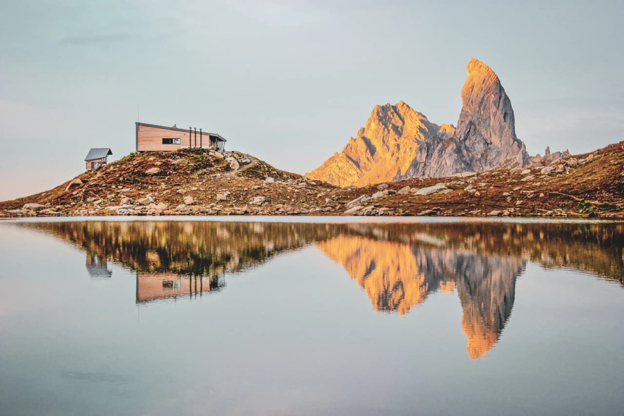
- Notable villages and stages: Beaufort, Queige, Mountain hut de la Croix de Bonhomme, Roselend dam, La Gittaz. Each offers an access point, services or the option of adapting the length of the stage.
The trail is generally signposted as a "Tour du Beaufortain". Some sections cross other well-known itineraries, such as the GR5 or the Via Alpina, offering the possibility of extending or shortening the walk. For a precise and up-to-date view of the route, it is advisable to consult the FFRandonnée topoguides or the IGN Cartes interactive maps, which make it easier to plan at your own pace.
The main stages of the Tour du Beaufortain
Each stage combines mountain trails, mountain pastures and crossings of typical villages. Here is an overview of the main stages and key passages:
The main stages of the route
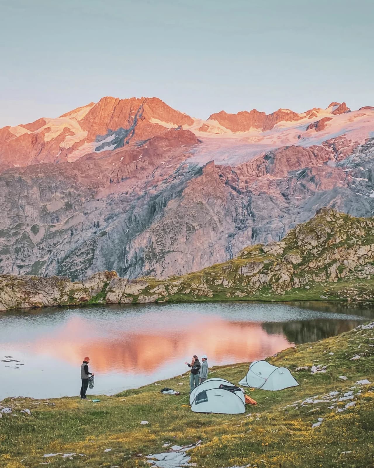
- Beaufort - Mountain hut de la Balme: Approximately 5 to 6 hours' walk. This first stage takes you through pastures and opens the way to the wild heights, passing through the village of Arêches.
- Mountain hut de la Balme - Mountain hut de Presset: 5 to 7 hours, including the ascent to the Col du Bresson, offering spectacular views of the Pierra Menta, then on to Lac d'Amour.
- Mountain hut de Presset - Mountain hut du Plan de la Lai: Approximately 5 hours. Panoramic route along the river banks and through Cormet d'Arêches towards Plan de la Lai, a historic mountain pasture site.
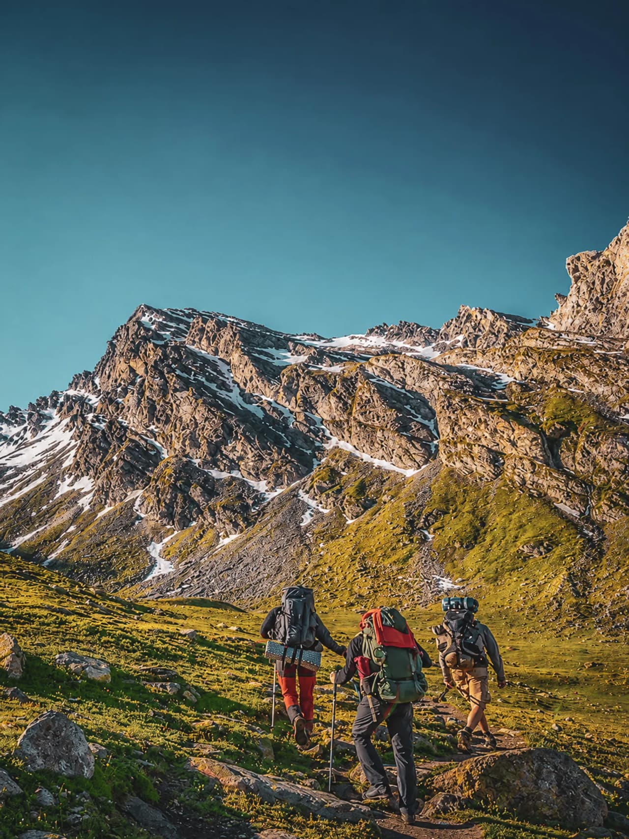
- Plan de la Lai - Mountain hut de la Croix de Pierre: Approximately 6 hours via the Col du Coin, an area ideal for spotting ibex.
- Croix de Pierre - Return to Beaufort: 4 to 6 hours via Lac de Roselend and a panoramic descent to the village of Beaufort.
Each section offers a mix of open mountain pastures, unspoilt forests and views of the glaciers. Some people choose to vary the number of stops or add an extra night in a Mountain hut, depending on their physical condition or their desire to take the time to explore further.
How difficult is the Tour du Beaufortain?
The Tour du Beaufortain requires a certain amount of physical preparation because of its rugged terrain and the length of the route. Understanding the total altitude difference, the distance to be covered and the level of difficulty helps you to adapt your training and define your stages realistically.
Basic data: altitude difference and distance
The entire Tour du Beaufortain route covers around 120 to 140 kilometres, depending on the options you choose. The cumulative Ascent is close to 7,000 metres. This combination makes it a great tour of moderate to sustained difficulty over several days.
- Classic distance: 120 to 140 km
- Ascent: between 6,500 and 7,200 m
- Number of stages: generally spread over 6 to 8 days
- Lowest point: around 750 m (Doron valley)
- Highest point: around 2,670 m (main passes)
Level of difficulty and preparation
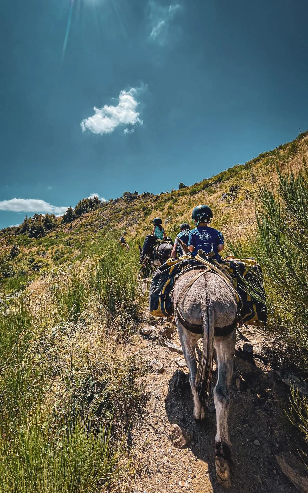
This loop is designed for those who already have some experience of mountain walking. The trails are well signposted, but sometimes have challenging sections: steep climbs, technical descents and snow-covered sections in early summer. The stages can cover between 15 and 25 kilometres a day, with daily vertical drops of up to 1,200 metres.
To prepare for your adventure, we recommend that you
- Practise walking for several days with a loaded rucksack (8 to 12 kg, depending on autonomy).
- Manage your breaks and hydration during the stages.
- Plan stages adapted to your condition and the pace of the group.
If you're looking for something more leisurely, you can also come to Savoie to hike, on our 4-day tour of the Hautes Bauges.
When to go and tips for a successful Beaufortain tour
The success of your tour of the Beaufortain depends very much on your choice of period, equipment and organisation on the trail. Anticipating these aspects ensures pleasant and safe stages through the massif.
Ideal time to go
The best season is from mid-June to the end of September. Mountain huts and accommodation normally open from mid-June. Outside this period, the presence of snow on the cols makes some passages technical or even impassable without special equipment. July and August are when the mountain pastures are in full bloom, but they are also the busiest months. Keep an eye on the mountain weather forecast the day before to plan each section, and let the Mountain huts know if there are any delays.
Equipment to bring
- Hiking boots suitable for stony, damp trails
- Layered clothing (technical T-shirt, fleece, waterproof jacket)
- Sun protection (cream, sunglasses, cap)
- Small first-aid kit (plasters, earplugs, anti-chafing cream)
- Light sleeping bag or sheet for unguarded Mountain huts
- Charged IGN map or GPS, external battery
A pack weighing less than 12 kg makes it easier to walk for several days. Limiting weight to the essentials guarantees comfort from stage to stage.
Tips for making the most of the route
- Book your overnight stays in advance, especially in high season
- Tell a friend or family member about your itinerary, or phone them when you pass through a village.
- Adapt each stage to your fitness level: you can shorten the route and use local transport to reach certain points.
- Make the most of the friendly atmosphere by talking to Mountain hut wardens, producers and other hikers.
- For simplified logistics, the Wildhartt guiding package offers a totally safe experience and complete organisation adapted to your pace.
Enjoy the authentic guided experience of the Tour du Beaufortain
After studying the route, the logistics and the level required for the Tour du Beaufortain, the guided experience appears to be a reassuring and rewarding solution for making the most of this great alpine trek. Opting for a guided tour with Wildhartt means opting for a turnkey organisation with experienced guides who know the massif, its weather and its specific uses inside out.
Guiding by expert guides
Outings organised in small groups limit the impact on the trails, while promoting conviviality and safety. Each guide has valid certification, in-depth knowledge of the mountain environment and the ability to adapt the pace to each individual's level. This means you can
- Receive personalised advice at every stage
- Progress with complete peace of mind on exposed or technical sections of the route
- Learn to read the terrain better and adjust your effort at altitude.
The educational approach of the guides also makes it easier to observe the fauna or discover elements of the local heritage, making the hike more immersive and instructive. Logistical management (Mountain hut bookings, meal management, rescue if necessary) is taken care of directly, so that hikers can concentrate on the pleasure of walking.
Flexibility and a friendly experience
Wildhartt's small groups encourage discussion and foster a collective spirit, whatever the level or age of the participants. The guiding staff make it easy to integrate novice and more experienced walkers into the same trip.
This format meets the following needs:
- Adapting the adventure to suit the weather and fatigue levels
- Advice on managing equipment and sharing tasks
- Discovering secret variations off the beaten track
You can also check out some of our trail expeditions for other ideas for guided sports walks.
Respect for the environment and good practice on the trail
The increasing use of trails in the Beaufortain requires everyone to adopt a responsible attitude to preserving the beauty of the massif and protecting local biodiversity. There are a number of simple gestures and principles to ensure that your hike has a minimal impact on the environment.
Key principles of responsible hiking
- Always stay on the marked paths to avoid erosion of the slopes and trampling of the fragile flora, particularly in the mountain pastures and near the lakes.
- Take all your rubbish with you, including food scraps and handkerchiefs. The Mountain huts and villages we pass through are equipped with waste collection points: don't leave anything behind on the route.
- Respect the tranquillity of wildlife. Do not approach wild or domestic animals, keep your distance from herds and close fences carefully after passing through.
- Avoid picking protected flowers or collecting minerals.
Respect for the environment also includes the careful use of resources in the Mountain hut: save water and energy, share communal areas in peace and quiet and limit your noise footprint to preserve the silence of the mountains.fires are prohibited outside the designated areas, to prevent fires and to avoid disturbing the natural environment.
Practical tips to minimise your impact
- Use biodegradable soap away from watercourses
- Use reusable water bottles rather than disposable ones
- Favour local products to support village economies and reduce the transport of goods
By opting for a guided tour via specialist operators like Wildhartt, each group benefits from regular reminders of these good practices and enjoys an organised hike that respects the environmental requirements of the Beaufortain region. To find out more, read our detailed policy on sustainability and eco-responsibility in all our expeditions.
FAQ about the Tour du Beaufortain
Finally, practical questions are often asked by Beaufortain walkers. Here are some direct answers to points that come up during preparation and on the trail:
Accommodation on the route
There are guarded Mountain huts, stopover gîtes and small inns along the route. Remember to book early in the summer, especially for well-known stages or weekends. For more information on availability and booking Mountain huts, visit the refuges.info website.
Food and refreshments
Some Mountain huts offer meals and picnic baskets on request. In the villages (Beaufort, Arêches, Queige), you'll find grocery shops, bakeries and cheese shops. Pack snacks between stages, as most Mountain huts are isolated and have no mini-markets nearby. If you want to be fully provisioned, you may need to adjust your itinerary to pass through a village en route.
Weather and safety
- Mountain weather is changeable even in summer. Check the weather forecast the day before or ask the Mountain hut wardens for advice.
- Rain gear and warm clothing must be available in your rucksack at all times.
- If in doubt about an exposed or snow-covered route, turn back or wait for others so as not to remain isolated.
- Don't forget to tell someone close to you about the route you are planning to take and the estimated crossing times at each key stage.
Safety and rescue
Most of the tour follows signposted, recognised routes, but some sections can quickly become complicated if you are tired or if the weather is bad. Emergency numbers (European 112) are available on most of the high ground, but not everywhere. It's best to use up-to-date GPS navigation applications and, if you're going on your own, check local updates regularly. Wildhartt accompanies each group with back-up equipment and a tracking device, providing peace of mind from the start to the end of the tour.
Duration, variations and levels of autonomy
The classic route takes around 6 to 8 days. But thanks to the many variants and access points, it's easy to envisage a shorter circuit (3 or 4 stages), or to join a shuttle bus in the valley to bring forward the end of the trek if necessary. This modular approach means that the Tour du Beaufortain can be enjoyed by a wide range of people, from sporty families to groups of friends in search of high altitude views.
You can find all the latest practical information from the local tourist offices or by contacting the Mountain huts directly. Before setting off, make sure you have a recent map of the route. For those who prefer to enjoy their hike with the help of recognised guiding, the Wildhartt team of guides offers an all-inclusive package for a safe and rewarding experience on every stage of the Beaufortain. For more guided adventure inspiration, explore our mountain and nature expeditions.

Find your next adventure
Browse curated expeditions matching the categories of this article and start planning your next trip.
Find your dream adventure
You might also like these adventures …
Hand-picked to echo the spirit of this article.

More to discover
Keep exploring with these pages and stories picked for you.

The legendary Haute Route Chamonix-Zermatt: Guide and history
Discover the legendary Chamonix Zermatt, its legend and the possibilities for exploring it.

Must-do itineraries: top 10 snowshoe hikes in Savoie
Discover the 10 best snowshoe hikes in Savoie. Experience a wild and magical adventure with every itinerary, advice and access included!
The ultimate guide to Mont Blanc climbing
Discover everything about the Mont Blanc mountain. Learn how to prepare yourself for Mont Blanc climbing with this ultimate guide.

Mountain Leader: The Ultimate Guide to Unforgettable Adventures
Find out how a mountain leader can transform your treks with expert advice. Get ready for adventure!

Top 7 of the most beautiful Pyrenees walks you must experience
Discover the 7 best walks in the Pyrenees to explore nature and experience adventure. Tips, itineraries and secret spots included.

The guide to Gran Paradiso: Sustainable outdoor adventures for 2025
Discover Gran Paradiso as your ultimate outdoor hotspot. Featuring sustainable expeditions, 2025 hiking tips, and a practical guide for every level.